Nowadays when I want to go somewhere but don’t have a clue where, I would just fire up Google Maps and look for interesting spots. It doesn’t matter where it is and how scarce the info about it is on the internet as long as it doesn’t take more than five hours of drive away, I’d get to it before the next day ends. This is exactly the story of how I got to know Mlangen Falls and what came next was one heck of an amazing adventure I’d always cherish in my lifetime.
Our Mlangen Falls Story
A week had passed since I started my ‘Backpacking Adventure‘ together with my cousin, Pani using our tuk-tuk. We had chosen General Santos as our base for this leg of our adventure where we plan to explore the provinces of Sultan Kudarat, South Cotabato, Sarangani, and Davao Occidental. I figured it’s the perfect location as it’s situated in the middle of all our target destinations, making access so much easier.
Our adventure was looking great and promising having kickstarted it in Balot Island the week before. I didn’t want to ruin the momentum so I thought of an immediate follow through. But I’m a scattered brain and I didn’t have a concrete route laid out yet. That’s when I thought about the ever-reliable Google Maps. So I pulled out my phone, fired the app, and boom! We had our next destination, Mlangen Falls, whose name I can barely pronounce but who cares!

According to Google, Mlangen Falls is located in Maitum. We’ve passed by Maitum before and it’s a progressive little town bordered by Lake Sebu and Palimbang. The highway leading to it from Gensan is completely cemented and flat. It doesn’t have steep or treacherous parts, except for those in Maasin. Passed that, the drive would be pretty much uneventful. I reckoned we’d be able to cover the distance within 3 hours at a moderate speed and another hour to Mlangen Falls.
The next day, we set for the ride early at 5:30 AM. But because my driver, Pani was especially grumpy that day, we had more stops for coffee, snacks, and cigarettes than what I had ever accounted for. Those were aside from his frequent bathroom breaks. This is the reason why lately, I hate drafting out itineraries for my trips. Because whenever I do so, I have certain expectations that would totally make me upset should they end up not being met.
For this trip, I included exploring Nalus and Kawil Falls before going back to General Santos but looking at how things were going, it looked like we’d never make it to these spots anymore.

We arrived in Maitum at 10:30 AM and stopped over for brunch before continuing the ride to Mlangen Falls at 11:30 AM. We took the usual route pointed to us by Google. Not long after the drive, we encountered a knocked-down bridge. After careful inspection, we determined that we couldn’t pass through it so we headed back to the town. There we asked the locals for directions.
The locals pointed us to a detour inside the banana plantation past Luan Bridge. Said we just need to always turn right at every intersection until we reach the highway again. That’s what we did but for some reason, it took us to some unpassable creeks. I got that we would be driving on unpaved roads but the ones we encountered had many obstructions such as logs and fallen trees. The further we drove, the deeper we were in the woods and that really unsettled me. Pani had also started to get aggravated so we decided to head back.
On our way back, we encountered children no more than 10 years old riding on their bikes. They might never know but I figured asking for the way out was worth a shot. And I was just glad that I took it since no more than 10 minutes later, we finally reached the highway. We continued to drive to Brgy. Tuanadatu which took us to the highlands. There were steep uphills and dangerous curves but the roads were already cemented all the way to our destination.
We reached Brgy. Tuanadatu at 1:00 PM and were greeted by helpful and friendly locals. The sky was starting to get gloomy which indicated that it was about to rain soon. Our guide, a 13-year-old boy named Donaire (Yes! The boxer) soon arrived. After paying the entrance fees, we immediately started the hike.
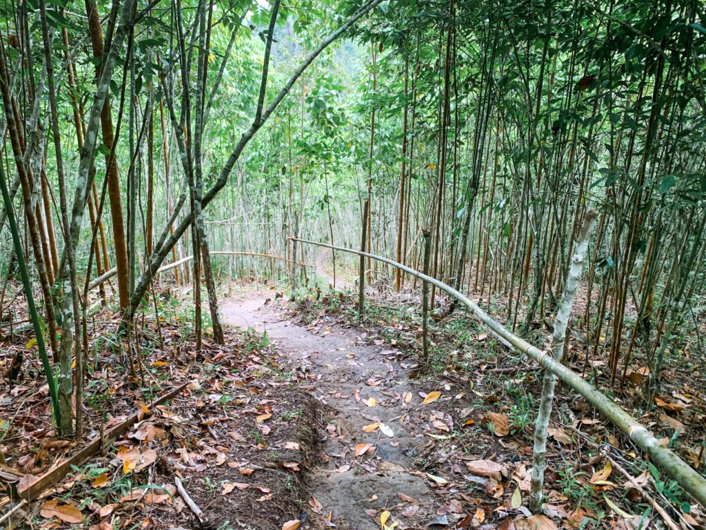
The hike began with flats followed by long downhills. They transitioned to some short uphills with even longer downhills in the mix. I figured they would be such a pain for me on our way back but that would be a problem for later. Some downhills were steep so I tried to focus on my footing so I wouldn’t trip. Given the klutz that I am, it wouldn’t even surprise me if I ever find myself rolling down those hills.
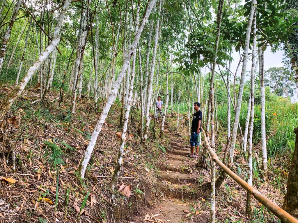
After covering the 3-kilometer distance from the trailhead, we arrived at a narrow trail leading into the woods. This was my favorite part of the hike as the view reminded me of some scenes in the anime. The entirety of that trail was surrounded by towering trees. I didn’t know what those trees were but they were thin like bamboo but with white trunks and branches.
The trail, which was very steep led us all the way down to Mlangen Falls. It was a good thing that the locals already carved the soil and made stairs to make it easier and less arduous to walk on. We finally arrived in Mlangen Falls after a good 30 minutes of hiking. There wasn’t anyone around and the deafening silence felt eerie yet peaceful. But I might not have felt so calm in such a quiet place in the middle of the woods had I been on my own.
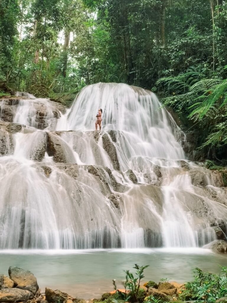
Mlangen Falls consists of 3-tiers of smooth limestone. I explored it from its top tier to the very bottom. At the bottom was a narrow catch basin no more than 3 meters wide. It stretches to each side of Mlangen Falls and was pretty shallow but was still good enough for swimming. It may not be good for a crowd but it can pretty much accommodate 5-6 people comfortably. I liked how delicately the cascades flowed down into it.
Mlangen Falls was gorgeous with icy cold waters. I spent a good amount of time bathing in it and admiring its grandeur until the rain finally came pouring down. I bet the downpour was heavier but I barely felt it in the canopy of trees overhead. What came down were merely drizzles that resembled the mists coming from the falls. My companions only watched me have fun from a safe distance as they were afraid of soaking themselves wet. I just sighed and thought that I would never understand them. Like how could someone be in a place with a beautiful waterfall and not want to bathe?
When I felt that the water was starting to catch speed, I immediately removed myself from it. It was raining after all and the possibility of flooding was just in the corner. We decided to head back and not risk getting stranded in the flood. Although the rain only felt like a drizzle inside the forest, the water in the creek warned us that it must be pretty strong outside the protection of the woods. As expected, I dreaded the hike back. Not only did it consist of steep uphills, it was muddy and slippery, too. Don’t worry! I survived. How else would I be sharing this story with you? However, it was such an ordeal but a worthwhile one for that matter.
How to Go to Mlangen Falls
General Santos City is the best entry point in going to Mlangen Falls. From here, simply ride a van or Yellow Bus to Maitum (3Hrs | ₱350/way). Get off at the town proper and hire a motorcycle to go to Brgy. Tuanadatu (30 Min | ₱500/2 people). Mlangen Falls can also be accessed from Lake Sebu but I can’t guarantee a safe and smooth ride since I’m not really aware of the road conditions.
Useful Travel Info
- The Entrance Fee to Mlangen Falls is ₱30/head. Getting a guide is not required but you can hire one for ₱200/5 people if you’re not familiar with the place.
- The road going to Mlangen Falls is already cemented. There was just a small part that was destroyed due to a landslide but it should already be taken care of by now. Construction efforts were ongoing during our visit.
- There was no cellular signal in the area. If you want to connect to the internet, Pisonets are available.
- Bring your own food. There are no restaurants there.
- There were three cottages available in Mlangen Falls which visitors can use on a first come first serve basis.
- Camping is not allowed in Mlangen Falls. If you want to spend the night, you can pitch your tent on the military base located just a few walks away from the trailhead.
- There’s a parking space for vehicles. The fee starts at ₱20.
- Bring enough water. There’s no water source available along the trail.
- The trail going to Mlangen Falls is along farms of corn, sugarcane, and pineapples. It can actually be reached by motorcycles. If you don’t feel like walking 3 kilometers, you can hire a motorcycle to take you to the start of the trail going down to the falls. The fare is ₱20/head/way.
- If your time permits, you can include white water tubing in Maitum and the waterfalls in Kiamba in your itinerary.
- As always, LEAVE NO TRACE. Dispose of your trash properly. Don’t vandalize. Don’t do anything that could disrupt the natural flow of things in Mlangen Falls.
Discover more from A Wanderful Sole
Subscribe to get the latest posts sent to your email.


