
Panimahawa Ridge is one of the well-known easy hikes in Bukidnon. Located in the town of Impasug-ong, this ridge offers panoramic views of the surrounding mountains and valleys, making it a popular spot for hikers and nature lovers. A hike to this beautiful mountain will treat you to its cool climate, rolling hills, and vibrant greenery, which provide a perfect backdrop for outdoor activities like trekking and camping. It is such a beauty that you can enjoy the picturesque views throughout the day, as well as during both sunrise and sunset.
PANIMAHAWA RIDGE TRAIL
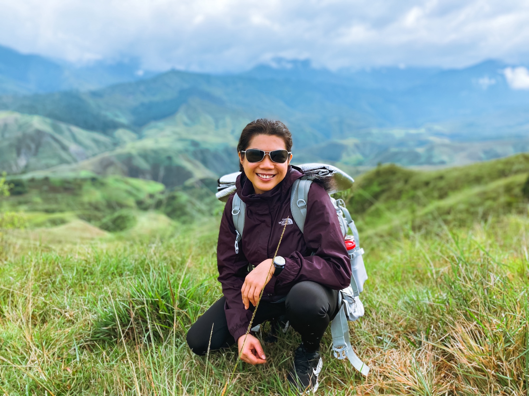
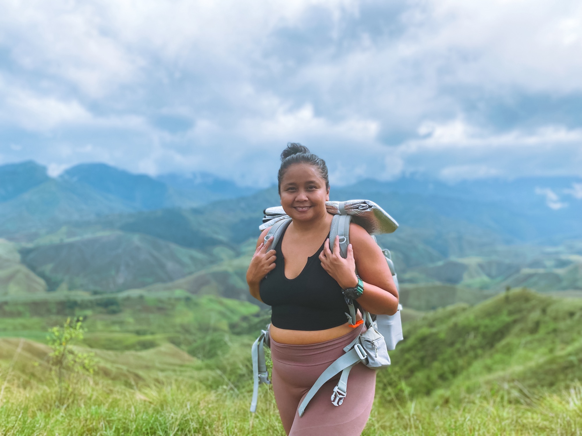
I recently went on an overnight hike to Panimahawa Ridge with my best friend, Rhea. It had been a while since we had traveled together, and she had been asking me to take her hiking. The timing was perfect because I was aiming to hike as many mountains as possible before climbing Mt. Apo in a few weeks. While I knew I should be tackling more difficult trails for training, I thought it would be ideal to go for something more relaxed since Rhea isn’t much of a hiker.


We met up in Malaybalay, where I was based at the time. The last time we were together was during our quick trip to Camp Eleaga. She had been wanting to let off steam for a long time, so I asked her to come visit me at my new home. I travel a lot throughout the country, but I prefer staying in one destination for a longer period. We didn’t have the chance to meet when I was in General Santos and Siargao, but this time, I wasn’t taking ‘No’ for an answer.


Rhea arrived at four in the afternoon. After buying our provisions, we rode the bus to Impalutao. The ride only lasted 20 minutes. When we got there, I contacted Sir Bob, with whom I had previously arranged our hike. He sent for our ride, which arrived after 15 minutes. From Impalutao Elementary School, the ride to the registration office took only 10 minutes along a rugged path. It was already dark when we reached the registration site.

We didn’t waste any time and started the hike after registering and securing a guide. The hike began with a quick ritual of offering coins to the local tribe’s ancestors. Afterward, we followed a flat path along cornfields that stretched for about 100 meters before reaching a trail leading down to the river. The trail was kind of steep and slippery, so I was careful not to trip. To make matters worse, I was carrying a flashlight in my other hand, which made the hike even more challenging.
I know you might be thinking that I should have brought a headlamp instead, but I actually didn’t plan for that. The original plan was to start hiking at 4 PM to witness the sunset in Panimahawa Ridge, so headlamps didn’t seem necessary since we could rely on our flashlights at the campsite. But, to be honest, I was just making excuses for my lack of preparation. Considering that we both struggle with being on time, I should have made the necessary adjustments. Maybe I just had too much faith in our friendship.


The hike down took about 20 minutes. After that, we crossed to the other side using a makeshift bamboo bridge. It was nerve-wracking because the bridge shook with every step. Fortunately, we were able to cross to the other side safely. The real challenge began here because the trail consisted of a long, steep ascent that stretched to about 300 meters. It reminded me so much of my hike in Buscalan, with the way the trail led me down and back up to reach my destination.


The trail in Panimahawa Ridge is quite rugged, with scattered rocks of various sizes and little room for breaks. Carrying our tent and flashlight in both hands made it difficult to maintain my balance during the ascent. Our guide kindly offered to carry our tent, which I gladly accepted. Despite hoping for an easier climb, it was still quite challenging. The only comfort I had was the beautiful starry skies.
After completing the first ascent in 45 minutes, we had a long walk on moderate slopes that lasted 20 minutes before we encountered another steep ascent to the campsite. I wish I could say I handled it easily, but it was quite a struggle. I couldn’t understand why. Maybe my expectation of an easy hike was sapping my willpower, which made the experience even more challenging.

The final ascent to the Panimahawa Ridge’s campsite was a long, straightforward climb on rocks and loose earth. It was slippery at times. We would stop for breaths once in a while and to admire the stars. From a distance, I could hear the voices of other campers, and their enthusiasm would give me short-lived energy to resume the hike. This went on for about an hour, but I was still thankful for making little progress. When we finally reached the campsite, it was like a huge burden was taken off my shoulders. Relief washed over me, and I couldn’t be more excited to finally start drinking wine!
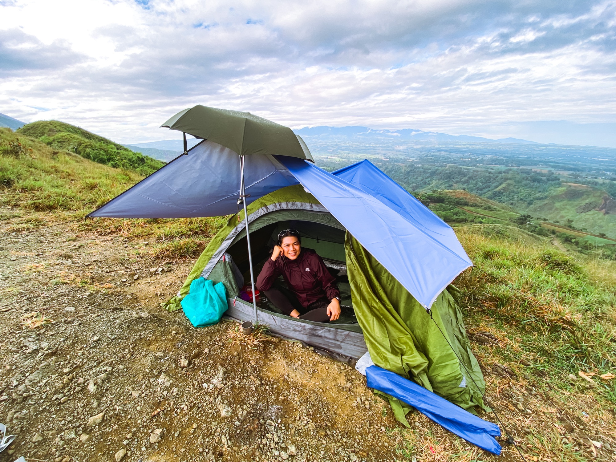
We set up camp near one of the peaks. It was challenging to find a good spot as we were also trying to avoid cow droppings that were everywhere. The last time I saw that much poop at a campsite was in Mt. Marami. Finally, we managed to complete the setup before the rain came pouring in. Our guide left us to be with his buddy in the other camp nearby. Rhea and I started our barbecue feast on my portable grill. It was a fun night, and we finished it by emptying a bottle of Novelino Sangria. Falling asleep was another struggle since Rhea was much of a skeptic and worried about every sound she heard outside of our tent. I was worn out, and sleep finally took over after reassuring her that everything was going to be okay.

In the morning, I was excited to see a beautiful sunrise over a sea of clouds, but it was disappointing as the sky was grey and gloomy due to the ongoing rain. I went back to sleep and woke up at 7 AM to prepare breakfast. Our guide joined us and we found out that he doesn’t eat pork, so he couldn’t join us for the barbecue. I offered him my favorite Purefoods Salpicao corned beef, as he was a nice kid and deserved it. After breakfast, we packed up our camp, took some photos, and began our descent using the same trail we used to go up. It was a great hike, made even better by sharing it with one of the people dear to me, and the views were remarkable despite the rain.
HOW TO GO TO PANIMAHAWA RIDGE
From Manila – Fly to Cagayan De Oro City. From Laguindingan Airport, ride a shuttle/van/taxi going to Agora Terminal. Fares range from ₱150 – ₱200/way. Ride a bus to Davao and get off at Impalutao Elementary School. From there, hire a motorcycle to take you to the registration site. You can contact Sir Bob at 0997 801 3135 ahead to arrange your ride. Total travel time from CDO to jumpoff is 3-4 hours.
From Davao – Ride a bus to Cagayan De Oro City and alight in Impalutao Elementary School. Hire a motorcycle to take you to the registration site.
From North Cotabato – If you are coming from visiting Asik-asik Falls, wait for the bus bound for Cagayan De Oro City along the national highway in Alamada town center and ride it going to Kalilangan. From Kalilangan, ride a bus going to Cagayan De Oro City via Impasug-ong and get off at Impalutao Elementary School. Hire a motorcycle to take you to the registration site.
WHERE TO STAY IN BUKIDNON
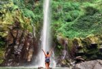
After hiking Panimahawa Ridge, an ideal side trip is chasing waterfalls in CEDAR or spending the night is some Instagram-worthy campsites and mountain resorts such as Roty’s Peak. However, if you prefer a more comfy stay that would allow you to remain connected and near places of interest such as bars and restaurants then here are some of your best choices in the area.

Kekehyu Business Hotel
Address: Sayre Highway, Valencia City, Bukidnon
– The superior services and facilities offered at Kekehyu Business Hotel will make for a memorable stay.

Hotel de Susana and Resort
Address: Sayre Highway, Valencia City, Bukidnon
– This property puts you close to attractions and interesting dining options. .

Malaybalay Air’bnb Travellers Inn
Address: Purok 6, Brgy. Casisang, Sayre Highway, Malaybalay City, Bukidnon
– This hotel is conveniently located along the highway and near attractions and convenient stores.
BUDGET & OTHER USEFUL INFO
| BASIC INFO | Name: Panimahawa Ridge Elevation: 870 MASL Location: Brgy. Impalutao, Impasug-ong, Bukidnon Difficulty: 2/9 |
| WHAT ARE THE FEES | ₱350/person for a group of 5. This already includes the registration and guide fee. If you're less than 5, the fee is still the same but your group will pay an additional ₱300. So for the two of us, the fee was ₱350/pax + ₱300. ₱50/person/way - Motorcycle from Impalutao to Basekamp |
| SUGGESTED ITINERARY (Overnight) | Day 1 15:00 ETA Impalutao Elementary School. Meetup. 15:30 Travel to Panimahawa Ridge Basekamp 15:45 ETA Panimahawa Ridge Basekamp. Register. 16:00 Start Hike 17:30 Summit. Sunset. Photo Ops. 18:00 Set up camp 19:00 Dinner 20:00 Socials 22:00 Lights out Day 2 05:00 Wake Up. Sunrise. 06:00 Breakfast 07:00 More photo ops 08:00 Break camp 08:30 Start Descent 10:00 ETA Basekamp. Freshen Up. 11:00 ETD 12:00 Lunch at Cowboy Town 13:00 CEDAR Side Trip 16:00 ETD Home |
| CONTACT | Sir Bob - 0997 801 3135 ***You can contact him for additional instructions and info for your hike. |


There you have it, lovelies. That’s it for our overnight hike to Panimahawa Ridge. If you’re wondering what else you can explore in Bukidnon after your hike then you might just find my day tour itinerary useful. To keep tabs on my adventure, just follow me on Facebook and Instagram. Feel free to leave your questions and suggestions in the comments. Until next time. Ciao!
Discover more from A Wanderful Sole
Subscribe to get the latest posts sent to your email.